Aerial Photos of Santa Cruz / photoa22Dave Francis10/20/99 |
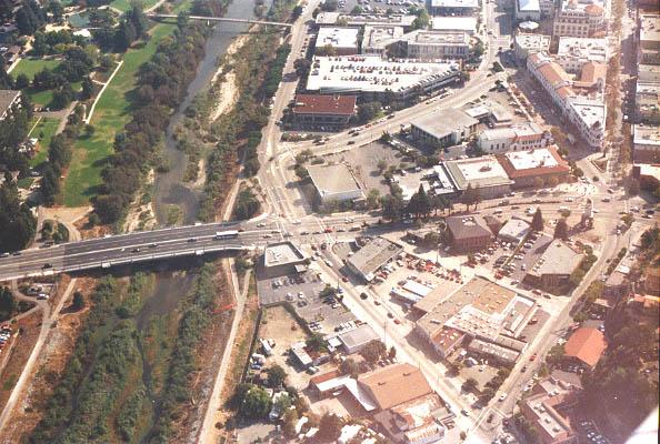
In the middle of the photo is the intersection of Water St. and River St., City of Santa Cruz. The San Lorenzo River is the green area on the lefthand side of the photo. The clock tower is in the middle, on the right side of the photo. Pacific Ave. runs off the upper righthand corner.
| Navigation to the Virtual Santa Cruz Exhibit | |
| 1906 Aerial photo of Santa Cruz | |
| Aerial photos of Santa Cruz | more aerial photos of Santa Cruz |
| Aerial photos of the Central Coast | Index of on-site photographs |
| Map Index of on-site photographs | |
| Navigation to the host Museum of Hiram | |||
| Main Entrance | Astrophotography | Genealogy | Library |
| Chronology | Museum History | Reference | Museum Index |