Looking Southeast Down Rt1, DavenportDave Francis10/20/99 |
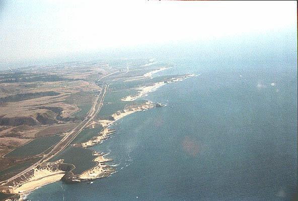
The is Highway 1 going southeast down the coast. Davenport is just to the left of the plane and Bonny Doon Beach can be seen at the lower left. Santa Cruz is off in the distance, lost in the haze.
| Navigation to the Virtual Santa Cruz Exhibit | |
| 1906 Aerial photo of Santa Cruz | |
| Aerial photos of Santa Cruz | more aerial photos of Santa Cruz |
| Aerial photos of the Central Coast | Index of on-site photographs |
| Map Index of on-site photographs | |
| Navigation to the host Museum of Hiram | |||
| Main Entrance | Astrophotography | Genealogy | Library |
| Chronology | Museum History | Reference | Museum Index |